 |
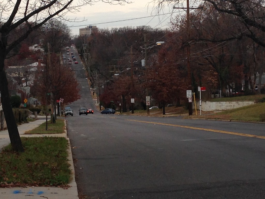
| Eastern Avenue project corridor Image: BikeSpecific |
The meeting, held December 7 at the EF International Language Center, 6896 Laurel Street NW, introduced the project to the public and helped define its scope. With planners and co-facilitators from Century Engineering, this meeting was the first of several that will occur through next year.
Project Details
The area along Eastern Avenue generally runs within the northeast section of the District, roughly from just beyond New Hampshire Avenue NE to Whittier Street NW, generally between the neighborhoods of Manor Park and Takoma. The street and much of the sidewalk, frontage, and retaining walls are within the District's right-of-way with some homes technically in Maryland but with portions of their front yards within District control, which would space for new sidewalks. The total project area is about 0.7 miles or about 3,700 feet.The goal of the project is to improve the existing pavement and landscape of the study area and to address deteriorated sidewalks, retaining walls, curbs, gutters, manholes, catch basins and sidewalk ramps. The project also hopes to improve pedestrian and bike safety; and to introduce other safety improvements or amenities along this corridor.
Existing Conditions
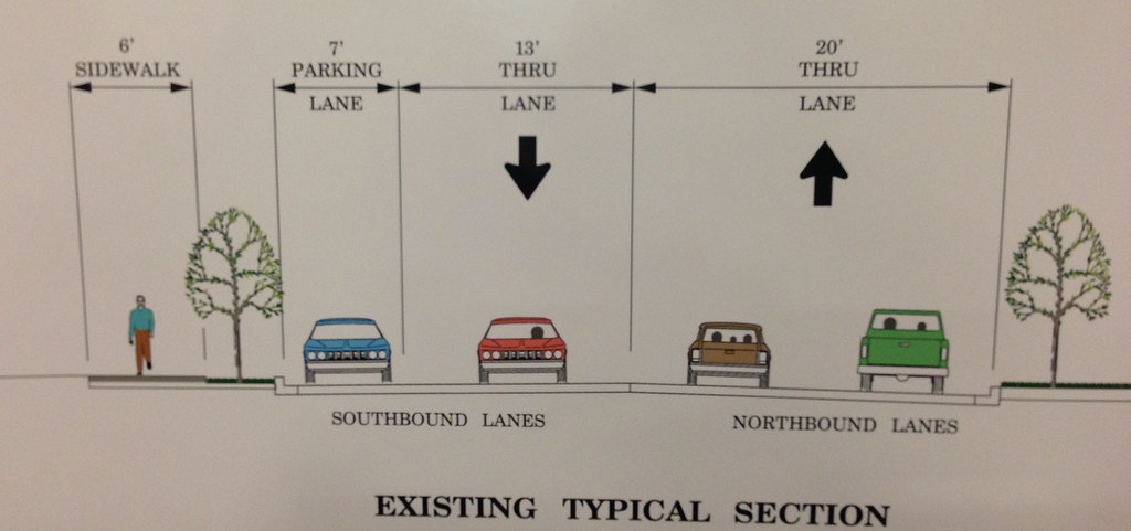
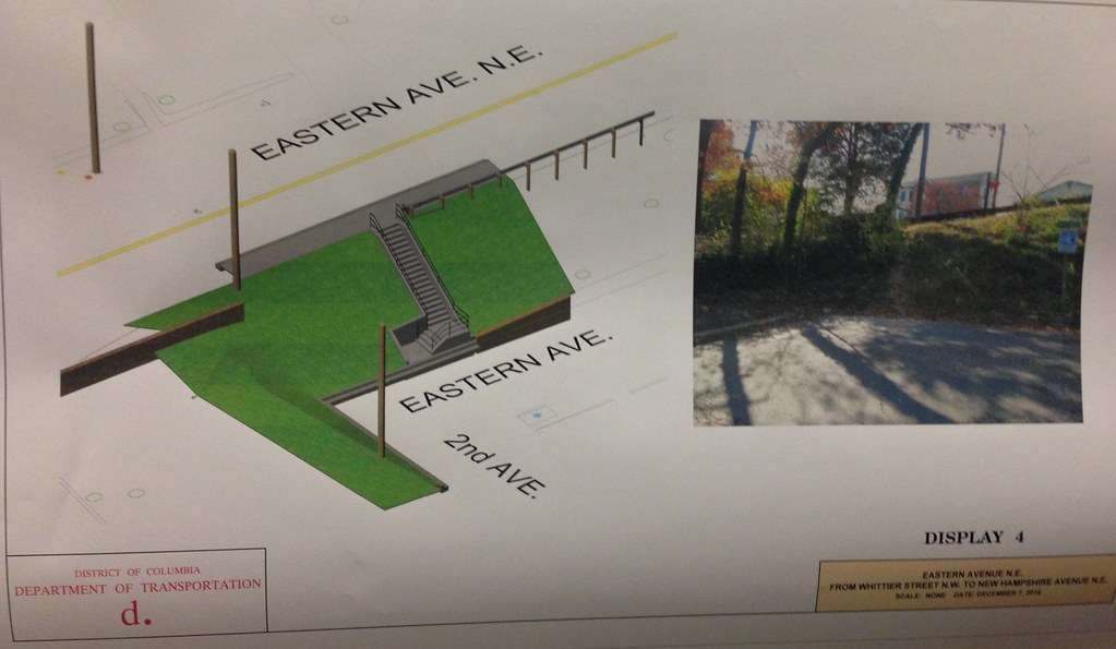 Also in this section, the road sits on an embankment and parallels "Little" Eastern Avenue, which runs adjacent to the construction area from just south of North Capitol Street to Walnut Street NW, which is just beyond the project area. To reach Little Eastern, residents and visitors created a "social trail", which informally connects to Eastern along the embankment.
As the roadway is built to traverse a valley that reaches its lowest point near Kansas Avenue, most vehicles exceed the speed limit, contributing to several reported crashes over the past several years. The steep grade and poor pavement make travel by bike difficult and potentially dangerous. At its steepest point, the Eastern Avenue gradient exceeds 10 percent.
While bicyclists use the road to connect with the Kansas Avenue bike lanes, current conditions make it difficult for many. In each direction from Kansas, cyclists must travel up steep roads with virtually no protection from on-coming traffic. Traveling downhill is just as difficult as cyclists must compete with fast-moving vehicles and poor road conditions.
Residents who attended the meeting complained that vehicles tend to travel a high rate of speed along the street and due to the terrain crossing the street feels unsafe. During winter, melting snow and refreezes, also contributing to crashes. Residents also noted the that sidewalks were particularly narrow, degraded, not Americans With Disabilities Act compliant or non-existent, particularly near the northbound bus stop where they also requested a bus shelter and pavement. Also, attendees requested that the project reduce road noise cause by speeding vehicles and large trucks using the road as a connector. Lastly, in the area of the Eastern Avenue embankment, some residents voiced concern about improvements that may make committing crimes easier.
Proposal Details
The key objectives for the project are to improve the quality of the roadway, provide safe bike access, and reduce vehicle speeds.
|
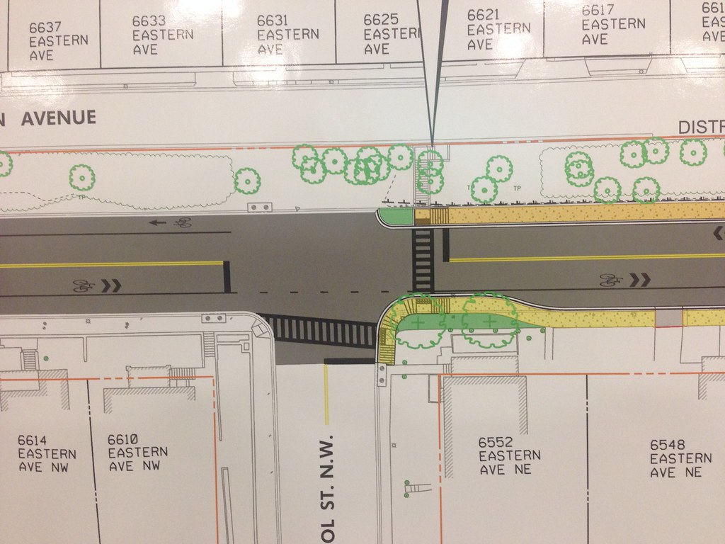 |
For bicyclists, the project calls for a reduction of travel lanes to two in each direction, with a combination of 8-foot bike lanes to allow for "hill climbing" and sharrows in certain flat or down hill sections. Certain section will maintain vehicle parking close to the curb, with bike lanes between them and the travel lanes. According to Paul Hoffman, the DDOT project manager, the Bicycle Program staff reviewed these initial plans.
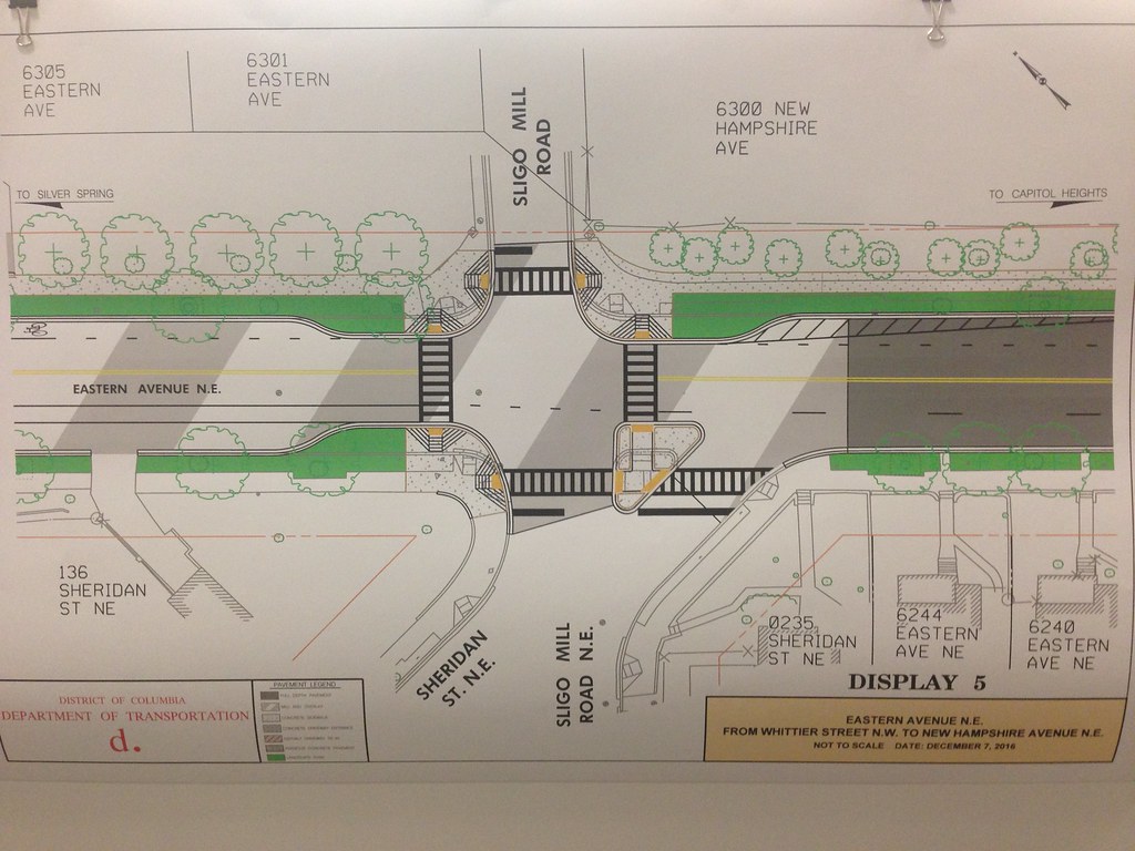 |
| Bike lanes end abruptly at this potentially difficult intersection Image: BikeSpecific |
Not currently in the project scope but less than a block to the south, the intersection of Eastern Avenue and New Hampshire Avenue is congested and has a history of accidents. According to a DDOT traffic safety report, the intersection of Eastern Avenue and New Hampshire had 46 collisions from 2002 through 2004.
Without wayfinding signage or a destination in mind, early plans suggest that the bike infrastructure may act to slow vehicle traffic but would not be particularly attractive to many bicyclists.
Additionally,Eastern doesn't provide a natural or direct North/South or East/West connection through the city. The street also does not connect with any particular point of interest south of the project area. The scope of the project ends at Whittier Street, about 1,000 feet short of Laurel Avenue in Takoma Park, MD. Attendees requested that bike lanes or sharrows be extended to Laurel Avenue near downtown. The project director stated that funding was limited to rebuilt further sections along the corridor but that comments would be included the study continues.
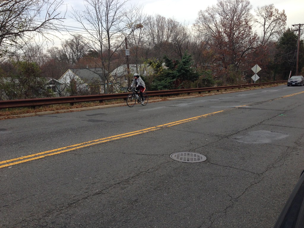 |
| A cyclist rides up Eastern Avenue on the embankment near Whittier Street NW Image: BikeSpecific |
The road will be reconstructed in 4 phases. Phases 1, 2, and 4 will completely close the road with limited space for street parking. Phase 3 has limited closures and focuses on the rebuilding of sidewalks and other pedestrian structures.
The design component of the project is scheduled to be completed by the fall of 2017 with construction to begin during the Summer of 2018. DDOT projects that the rebuilding will conclude by the winter of 2019.
Comments
Post a Comment
Thanks for your comment!