 |
DDOT asks how do people use the trail
Image: Author |
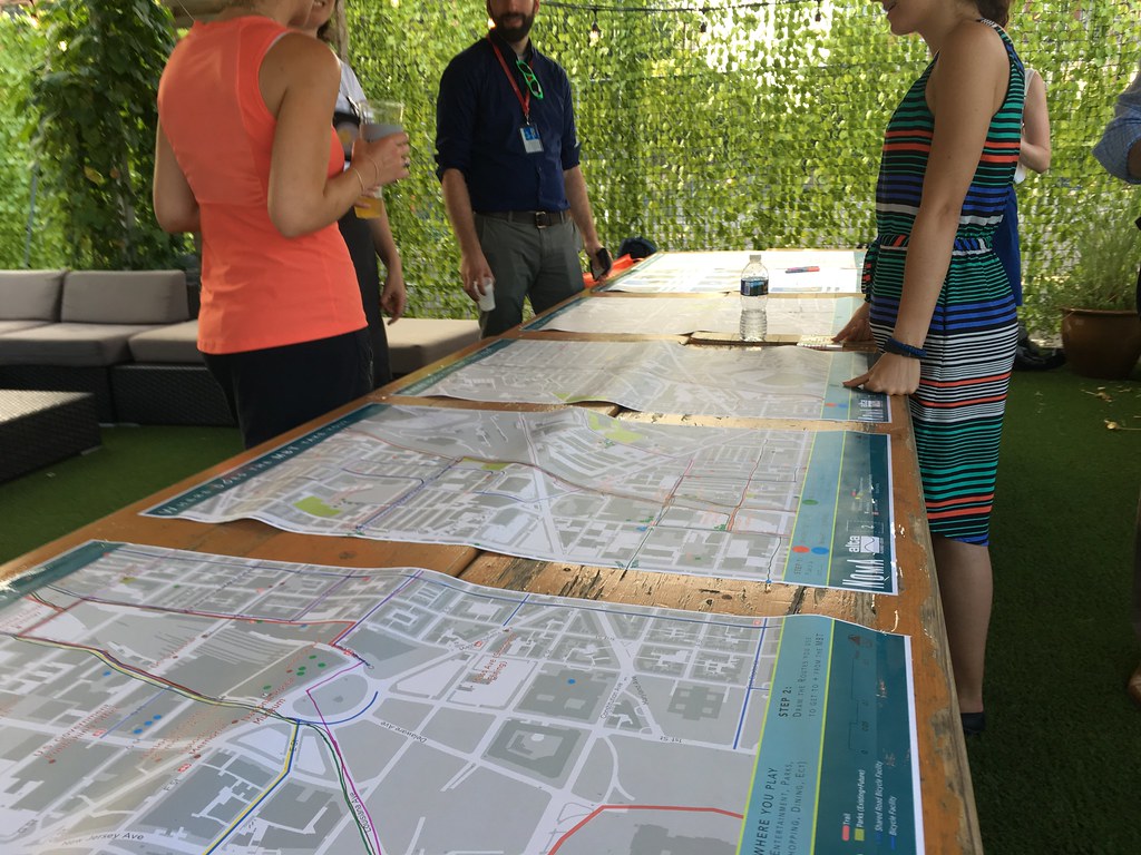
Thursday, July 13, The District Department of Transportation (DDOT) and the
NoMa Business Improvement District (BID) held a public meeting at the
Wunder Garten to view potential wayfinding signage for the Metropolitan Branch Trail (MBT). DDOT and the BID want your ideas on how that signage should look and what it should say.
According to the BID, the purpose of this meeting was to engage trail users in developing a plan for additional wayfinding signage on and near the MBT between Union Station and Michigan Avenue. The team asked participants how they connected to the trail - using it to travel to and from work, for recreation, for errands, or all of the above.
Currently, the MBT and the First and M Street NE protected bike lanes
contain several types of signage - some of it different from the run-of-the-mill bike lanes signs, some of it MBT-specific - to provide wayfinding
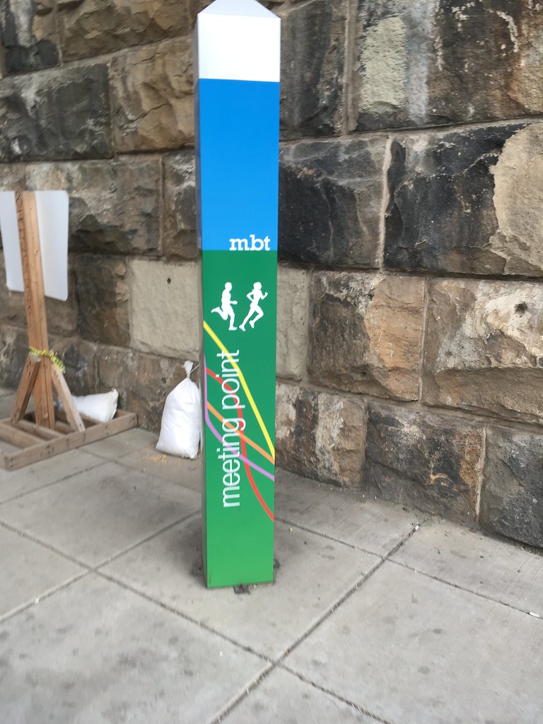
information to its users. Early in the trail's planning, DDOT adopted
the familiar "mbt" white, burgundy-ish, green signs that dot the area.
Later, DDOT and developers near the trail used different signs to show
where users were on the trail and where they may want to go.
The BID and DDOT are considering streamlining the hodgepodge of signage or adding to it. Potentially, the signage could lead to a "branding" or designated the MBT route on maps and on connecting streets with bike infrastructure. This would
allow current and new MBT users to easily identify the location of the
trail and where it goes.
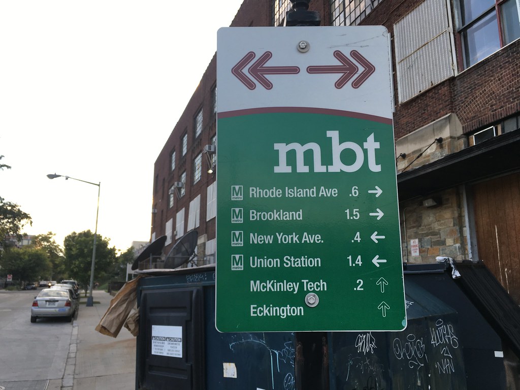
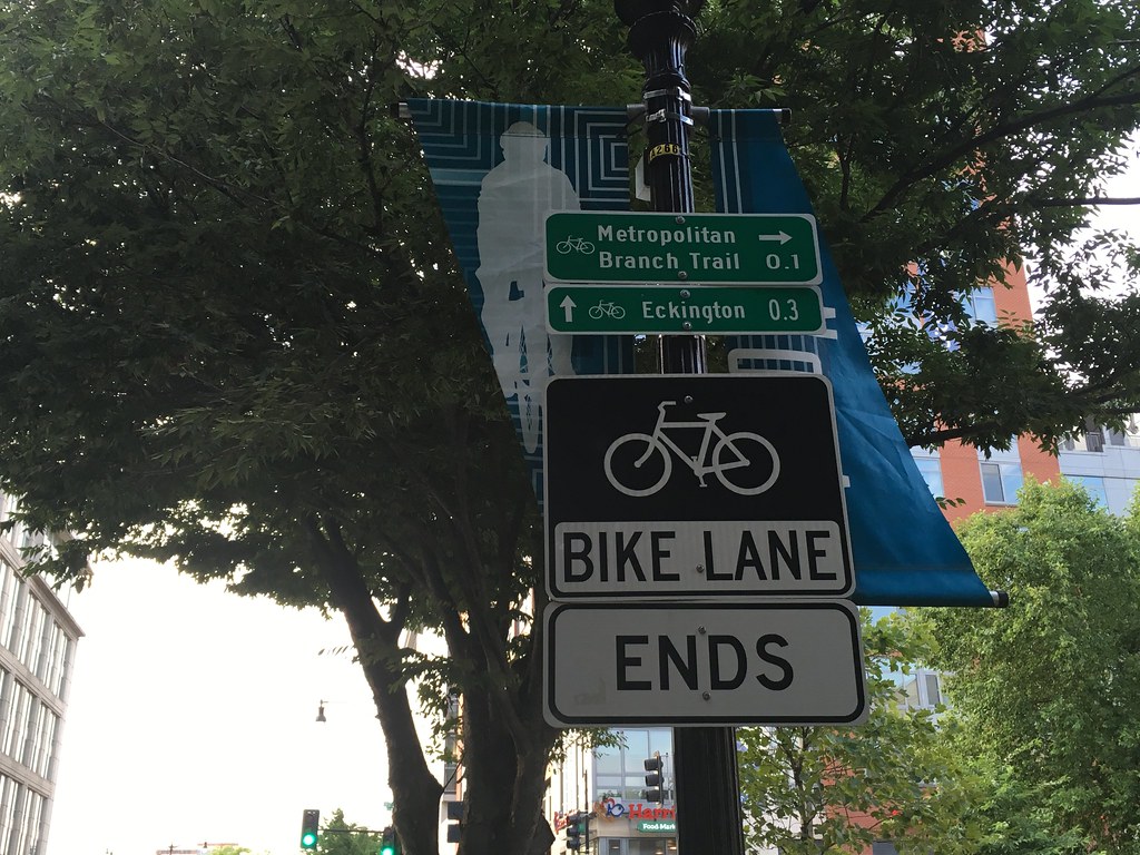
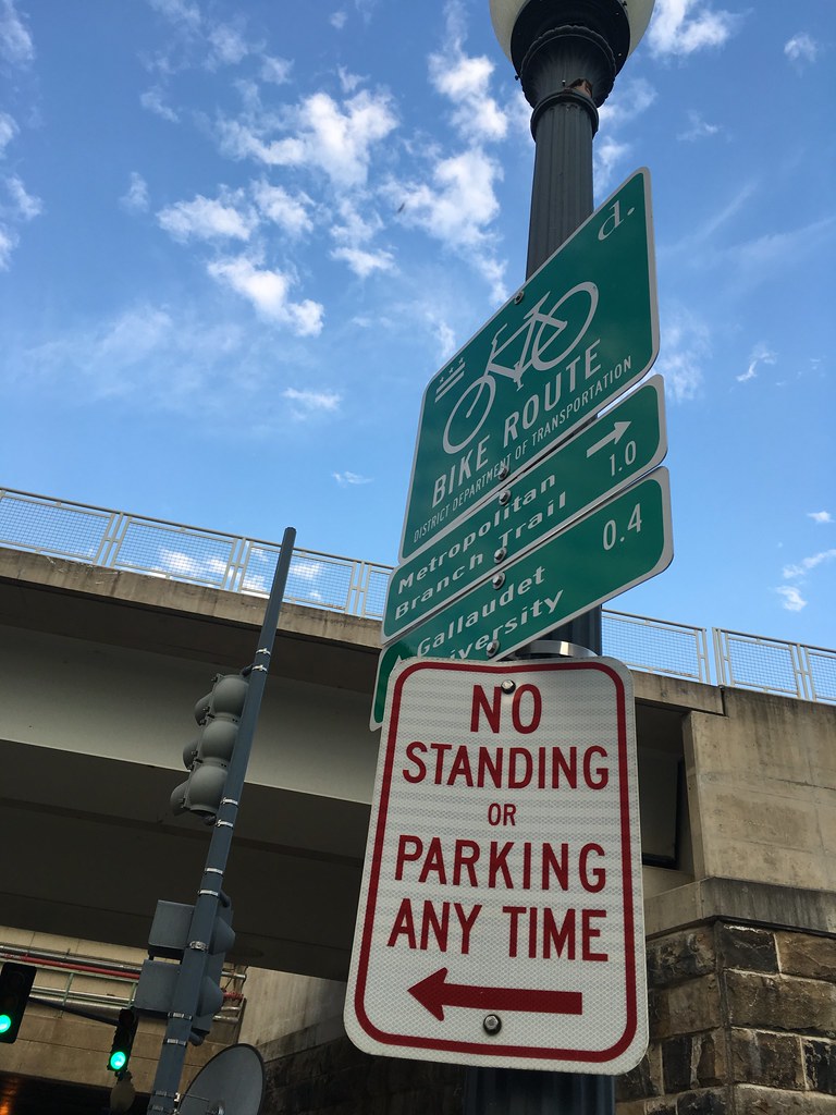
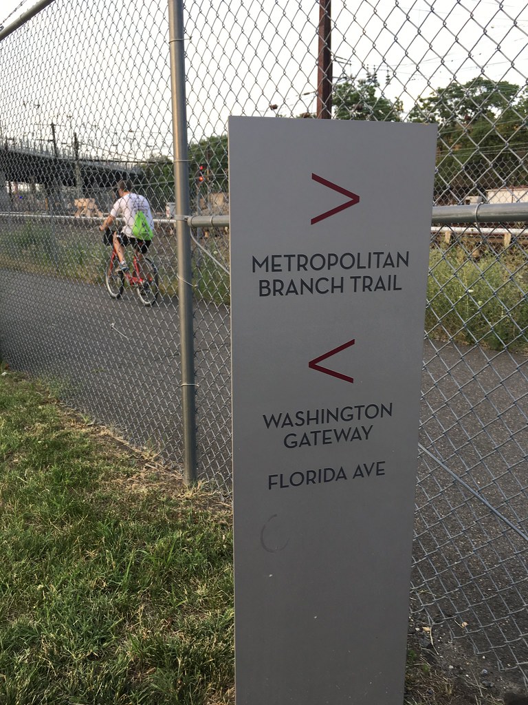
The images below show the variations in signage along the trail.
 |
| 1 |
|
 |
| 2 |
|
The original sign scheme - labeled #1 - was one of the popular signs as it identifies the trail, shows direction and distance to points of interest, and looks appealing. Signs #2 and #3 are consistent with current DDOT standards for most on-street trails and provide direction and identify that users are on a bike route. One of the least picks signs was #4, located at the Elevation residential development that abuts the trail just south of New York Avenue NE. Participants noted that it was relatively low-standing and easily missed and doesn't provide much in the way of information. Sign #5 acts as a trailhead or starting point while #6, which is similar in design to the traditional signage but provides distance travel from the start of the trail.
If you missed the meeting - and the beer - the NoMa BID created a
survey to help the team determine the best approach. The short survey asks participants to rate the usefulness of signs along the MBT corridor. Further, it how people travel along the corridor and their starting and ending points. Please take a moment to take the survey and make sure to add your comments on potential directional improvements on it.
You'll have to get your own beer...

Comments
Post a Comment
Thanks for your comment!